First: Don’t do what we did! In retrospect, its insanity!
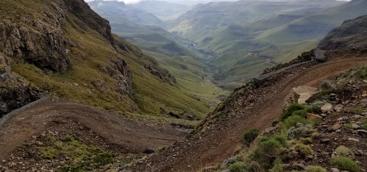
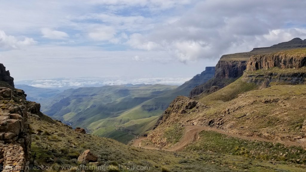
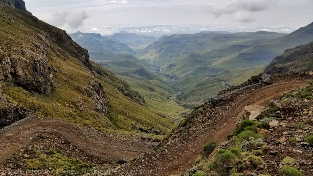
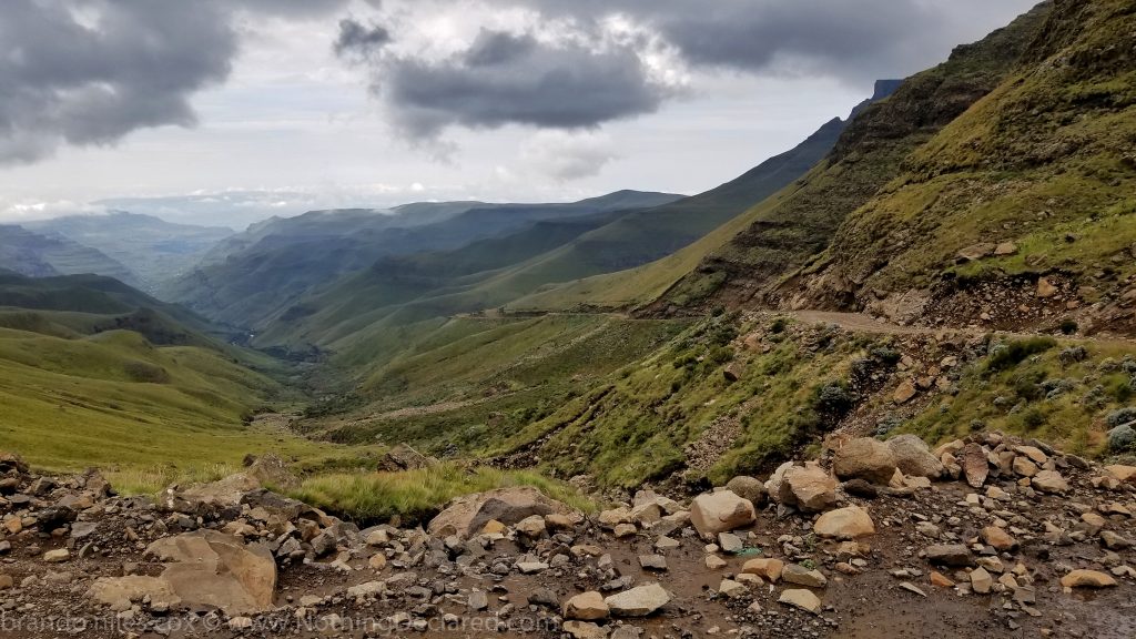
At the Roof of Africa lies the narrow Sani Pass, an infamously steep “4×4 only” winding high mountain pass connecting the eastern edge of Lesotho and South Africa. With names like Devil’s Corner, Hairpin Bend, and Suicide Bend, the route’s treacherous conditions, narrow winding hairpin turns, plunging cliffs and switchbacks have claimed many lives. The pass is littered with carcasses of numerous vehicles that failed to make it. Frequently listed as one of the world’s most dangerous roads, the dirt road begins at 2,876m (9,400ft) and steeply descends 1,000m (3281ft) in 8km (5mi) with an average gradient of 1:10 and frequent gradients of up to 1:3!
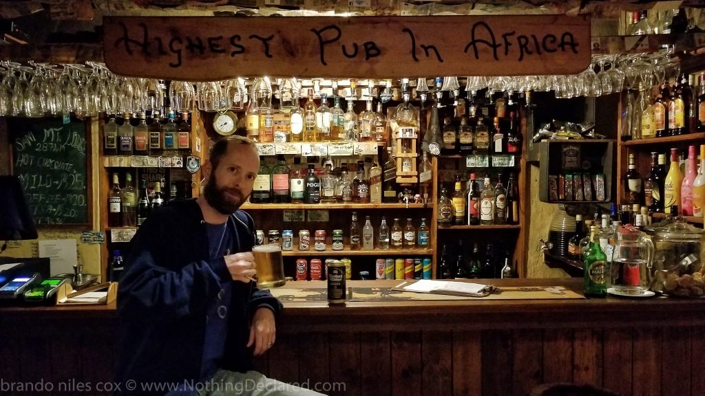
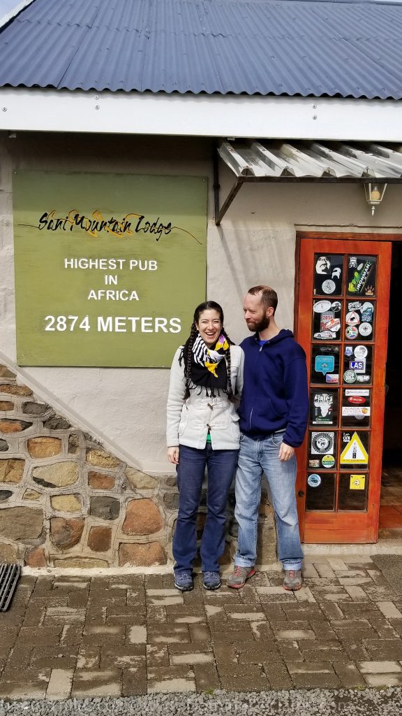
We arrived late at night atop the pass on the Lesotho side following an absolutely beautiful drive across Lesotho through the Drakensburg Mountains. After checking into the Sani Mountain Lodge, we settled down with a cold Windhoek Beer at the highest pub in Africa. In the dark of night, we didn’t realize the hidden beauty which stretched beyond the pub into the darkness. At breakfast the next day we were amazed to see the pub sits on the edge of a cliff face, with amazing views stretching into the valley below. This was also my first view of the Sani Pass, and it looked treacherous even for the Land Rovers slowly crawling over the rocks below.
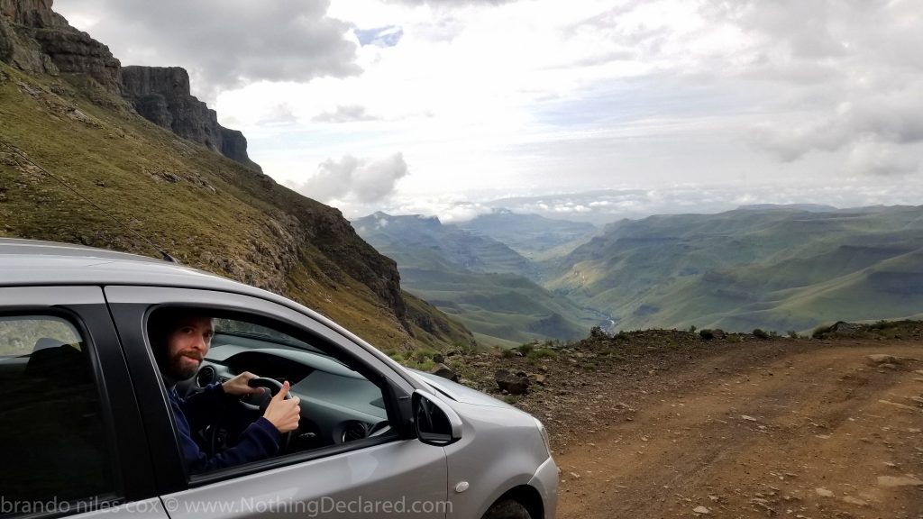
I looked back at my tiny subcompact rental car. In order to avoid the pass, we would have to drive back through Lesotho to get to Durban, costing us 7+ hours of extra driving time. Everyone at the top had massive 4x4s and said it was impossible in our vehicle. The situation would have been worse on the South African side; we would not legally be able to use the pass. A South African law in 1987 restricts access to 4×4 vehicles with enough ground clearance, and each vehicle is checked at the border. Lesotho side? They just waved us ahead!
My nerves were wrecked. I spoke with several groups of travelers at the top. We looked at our subcompact 2-wheel drive car’s ground clearance. We talked about its short footprint. It seems crazy, but we developed a plan! A group of Germans in a large off-road truck would go in front of us. A South African family would follow us an hour later in a Land Cruiser should we need a tow. Finally, a group of South Africans in a Land Rover would descend 2 hours later. Begin the insanity!
The first 500m of the trail is a 1:3 gradient with some of the most perilous terrain I have ever seen. We creeped over the rocks at a snail’s pace, carefully choosing my line with the utmost respect for both the thousand meter drop-off, as well as the countless large rocks littering the path. Emily served as a spotter, constantly pointing out large pointy rocks, as well as ruts and gorges I could not cross.
About 750m into the Sani Pass we encountered a group of hikers. Several were huddled around a bleeding girl, their first aid kit out and trying to bandage her knee. I stopped and asked if they were ok. They were not and I offered to take them down in our tiny car. Now there were 4 of us in this ridiculous, tiny vehicle. A most incapable ambulance!


The next 1000 meters progressed very slowly, as we crossed the narrow switchbacks now with the fun addition of several waterfalls, which become creeks passing over the “road.” Fortunately, we were able to deliver our injured hikers to their Land Rover just in time. “Fortunately”, because I’m not sure we could have completed the next portion with the extra weight onboard.
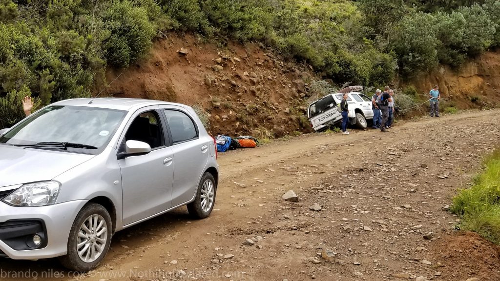
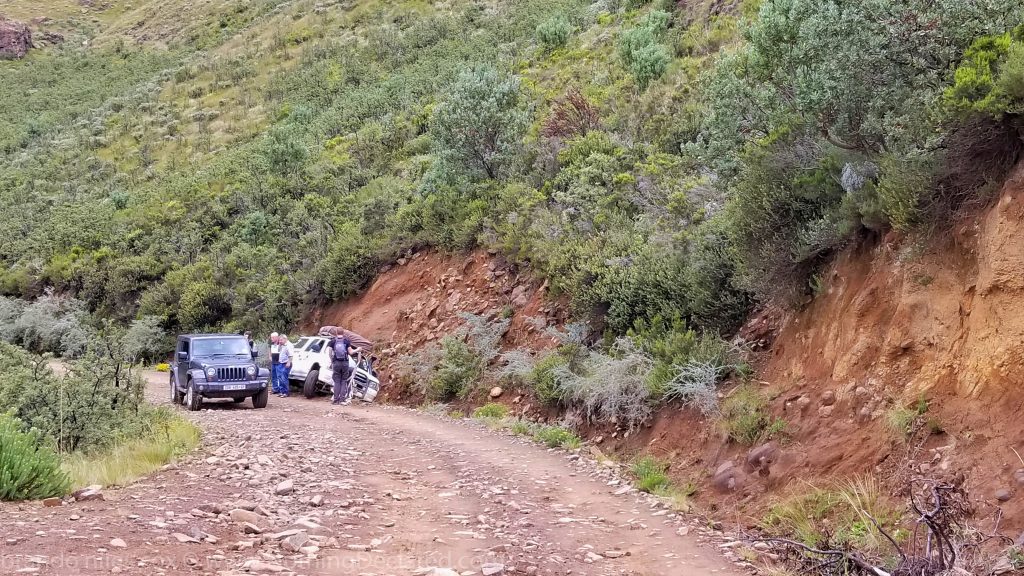
Another incredibly steep 1:3 gradient awaited us, stretching for almost 1km. In fact, there was no relief from treacherous conditions at any point and I would never recommend anyone to follow our example. A short time later, we encountered a large truck which had slid off the road. Several people were outside the vehicle with towropes trying to judge how they would be rescued.
We spoke to a South African man in a Jeep who couldn’t believe the tiny vehicle we were taking down the pass. He exclaimed, “Whoa! Man, you have some huge balls going down this pass in that thing. I can’t absolutely believe it.” He was in disbelief, and asked to take our picture. That was comforting. We were ¼ of the way through.

An hour later, we reached the halfway point, where we had lunch and encountered a caravan of the 10 4x4s on a tour up the Pass. The drivers’ reactions were a mixture of respect and amazement; their passengers just looked on confused. We relaxed and enjoyed the amazing scenery, which there was a lot of. Eventually, our South African friend from the top passed us. He was very proud for us, and happy we hadn’t tumbled to our doom. We made it to the South African Border post after crossing a small stream!
The 12 km after the South African border was only slightly better than the Sani Pass itself, but still quite treacherous requiring lots of concentration. The worst aspect of this section is the clay, which streams and rain form into lakes of syrupy mud littered with large rocks. It’s easy to get stuck in the mud, and you need momentum and speed to avoid this peril. However, speed increases your chance of hitting a large hidden rock.
Fortunately, I was able to avoid both of these threats and we reached the end of the road an hour or so later! We finally crossed onto a paved road after 3 hours of extreme, nerve-wracking driving through the most beautiful scenery I had ever seen! I had never been so relieved to encounter a totally normal road. We had made it unscathed through one of the most perilous mountain passes in the world!

